Publicizing geospatial and meta data at the national geoportal by local self-government bodies - recommendations
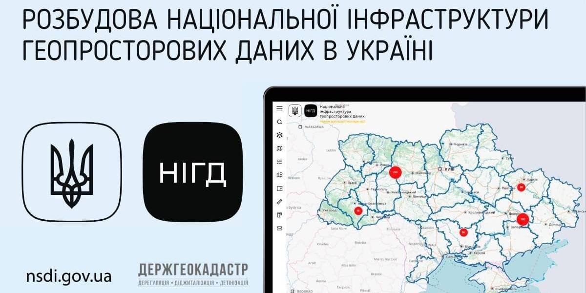
Ukraine is undergoing the process of creating, functioning and developing the national infrastructure of geospatial data. Under the legislation, executive bodies and local self-government are obliged to publicize geospatial and meta data at their official websites and reflect them with the help of the access service at the national geoportal.
The national geoportal prototype is functioning in the experimenting exploitation mode (nsdi.gov.ua), administered by the public enterprise «Scientific and research institute of mapping and geodesy». At the portal, 689 sets of geospatial data from the national, regional and local levels are available for browsing, downloading and processing.

Tags:
amalgamation of hromadas spatial planning
Source:
Державна служба України з питань геодезії, картографії та кадастру
07 April 2026
Засади розмежування та розподілу повноважень...
7 квітня Верховна Рада прийняла за основу урядовий законопроєкт про засади розмежування та розподілу повноважень між...
07 April 2026
Мапа ресурсів для розвитку громад та бізнесу — додавайте свої можливості і ставайте частиною змін!
Мапа ресурсів для розвитку громад та бізнесу —...
В Україні вже є інструмент, який економить сотні годин пошуку і відкриває доступ до багатьох ресурсів для розвитку та...
06 April 2026
Анонс: вебінар «Громадські обговорення під час...
Запрошуємо керівників органів управління освітою, управлінські команди закладів освіти та юристів органів...
06 April 2026
Підтримка сільських громад, удосконалення...
Підтримка сільських громад, удосконалення виборчої системи, посилення ролі асоціацій ОМС – ключові питання для...