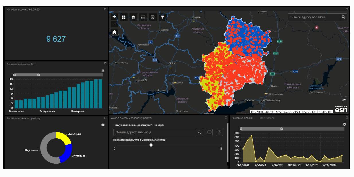
Fire monitoring and analysis maps have been developed for municipalities of eastern Ukraine
Within the project “No smoking” it was suggested that a geo-analytical tool (map) of fire monitoring and analysis should be developed on the basis of operational satellite and retrospective information on fires for the last five years for the purpose of efficiently planning preventive measures aimed at fighting large scale fires in municipalities. According to the competitive selection results, ten municipalities of the Donetsk and Luhansk oblasts. Moreover, regional maps enabling to analyze fire condition and dynamics for the last five years on the territory of the two oblasts.
The map has been developed on the basis of NASA satellite data, Public Cadastre Map, Nature Reserve Fund, including a set of information and analytical tools in terms of fire dynamics, location and scale, the area damaged by fire, etc.
Feel free to get acquainted with the developed maps at municipality sites or at https://cid.center/e-solutions/.

Tags:
Область:
Донецька область Луганська областьSource:
Центру розвитку інновацій
27 July 2026
Vacancy: Project Coordinator for Local Implementation Support
Vacancy: Project Coordinator for Local...
Description of the context To address the changing needs of Ukrainian municipalities and national level...
27 July 2026
UCORD підготував посібник з кадрової політики для агенцій регіонального розвитку
UCORD підготував посібник з кадрової політики...
Як побудувати сучасну систему управління персоналом в агенції регіонального розвитку? Як організувати прозорий добір...
25 July 2026
Майбутнє українських громад: Олександр Корнієнко - у подкасті «Врядування»
Майбутнє українських громад: Олександр...
«Якщо хоча б третина наших громад зможе одним реченням сказати, що це за громада і чого вона хоче,...
24 July 2026
Реорганізація чи перепрофілювання: як не помилитися, створюючи ліцей
Реорганізація чи перепрофілювання: як не...
Сесія ради громади відбулася. Рішення ухвалено. Школа І–ІІІ ступенів має стати академічним ліцеєм і,...