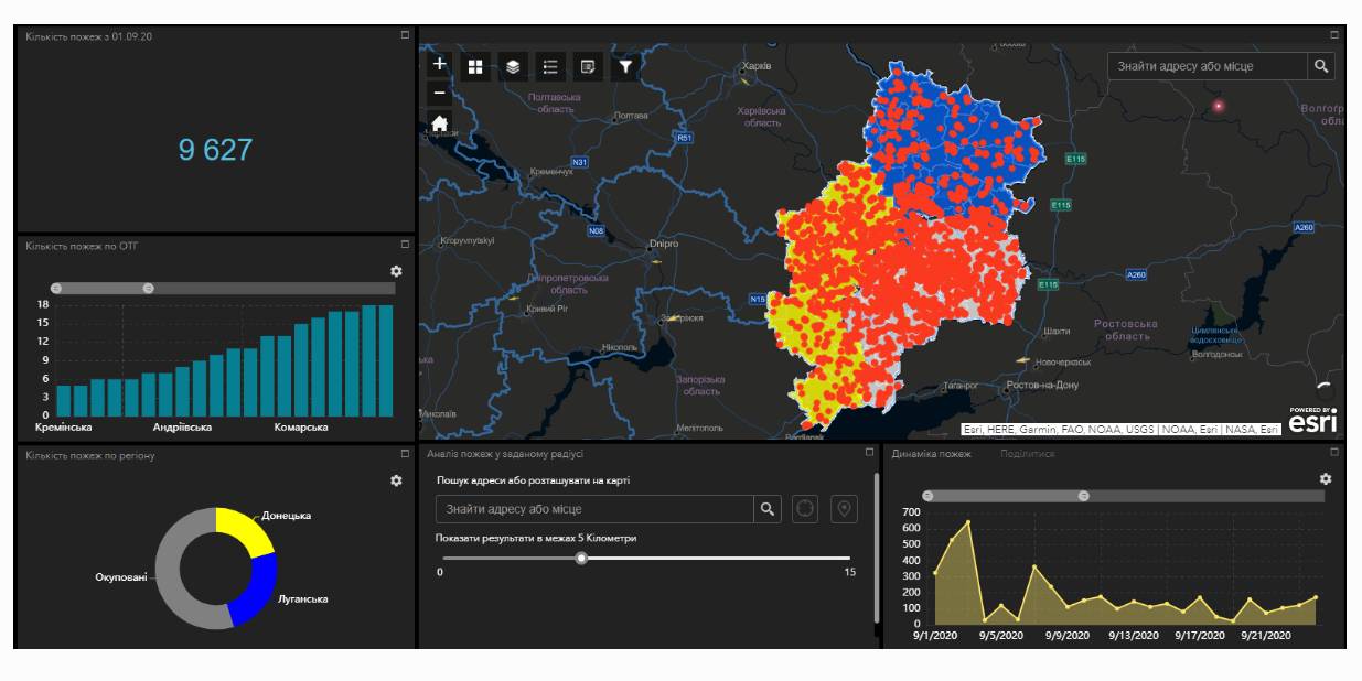
Fire monitoring and analysis maps have been developed for municipalities of eastern Ukraine
Within the project “No smoking” it was suggested that a geo-analytical tool (map) of fire monitoring and analysis should be developed on the basis of operational satellite and retrospective information on fires for the last five years for the purpose of efficiently planning preventive measures aimed at fighting large scale fires in municipalities. According to the competitive selection results, ten municipalities of the Donetsk and Luhansk oblasts. Moreover, regional maps enabling to analyze fire condition and dynamics for the last five years on the territory of the two oblasts.
The map has been developed on the basis of NASA satellite data, Public Cadastre Map, Nature Reserve Fund, including a set of information and analytical tools in terms of fire dynamics, location and scale, the area damaged by fire, etc.
Feel free to get acquainted with the developed maps at municipality sites or at https://cid.center/e-solutions/.

Tags:
Область:
Донецька область Луганська областьSource:
Центру розвитку інновацій
06 April 2026
Анонс: вебінар «Громадські обговорення під час...
Запрошуємо керівників органів управління освітою, управлінські команди закладів освіти та юристів органів...
06 April 2026
Підтримка сільських громад, удосконалення...
Підтримка сільських громад, удосконалення виборчої системи, посилення ролі асоціацій ОМС – ключові питання для...
06 April 2026
«5,4 млрд євро на стійкість: громади мають виконати плани до 1 жовтня 2026 року» – Олексій Кулеба
«5,4 млрд євро на стійкість: громади мають...
Віцепрем’єр-міністр з відновлення України – Міністр розвитку громад та територій Олексій Кулеба в інтерв’ю...
06 April 2026
Анонс: вебінар «Піклувальна рада закладів...
Запрошуємо керівників органів управління освітою, управлінські команди територіальних громад та керівників...