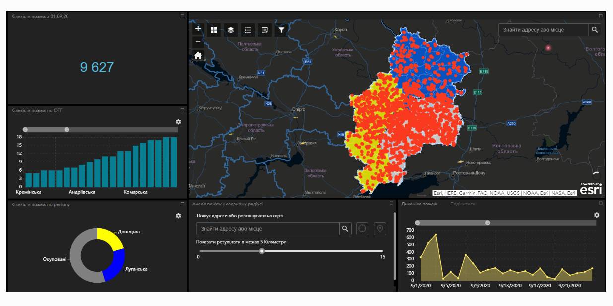
Fire monitoring and analysis maps have been developed for municipalities of eastern Ukraine
Within the project “No smoking” it was suggested that a geo-analytical tool (map) of fire monitoring and analysis should be developed on the basis of operational satellite and retrospective information on fires for the last five years for the purpose of efficiently planning preventive measures aimed at fighting large scale fires in municipalities. According to the competitive selection results, ten municipalities of the Donetsk and Luhansk oblasts. Moreover, regional maps enabling to analyze fire condition and dynamics for the last five years on the territory of the two oblasts.
The map has been developed on the basis of NASA satellite data, Public Cadastre Map, Nature Reserve Fund, including a set of information and analytical tools in terms of fire dynamics, location and scale, the area damaged by fire, etc.
Feel free to get acquainted with the developed maps at municipality sites or at https://cid.center/e-solutions/.

Tags:
Область:
Донецька область Луганська областьSource:
Центру розвитку інновацій
19 June 2026
«Старі методи профорієнтації вже не працюють». Як у Броварському коледжі закохують дітей у професії
«Старі методи профорієнтації вже не працюють»....
Колись профорієнтація від закладів профтехосвіти виглядала так: агітбригада приїздила до школи, розкладала буклети й...
19 June 2026
Бюджетна декларація 2027–2029: ключові аспекти, що стосуються місцевого самоврядування
Бюджетна декларація 2027–2029: ключові аспекти,...
KSE Institute: Юлія Маркуц, Андрій Дарковіч, Владислав Шиманський Бюджетна декларація на 2027–2029 роки...
18 June 2026
Проєкт DECIDE – партнер Фестивалю «Вчителі майбутнього»
Проєкт DECIDE – партнер Фестивалю «Вчителі...
18-19 червня у Львові відбудеться Фестиваль «Вчителі майбутнього», який збере освітян, управлінців, експертів,...
18 June 2026
Уряд затвердив Середньостроковий план пріоритетних публічних інвестицій держави на 2027–2029 роки
Уряд затвердив Середньостроковий план...
Кабінет Міністрів України затвердив Середньостроковий план пріоритетних публічних інвестицій держави на 2027–2029...