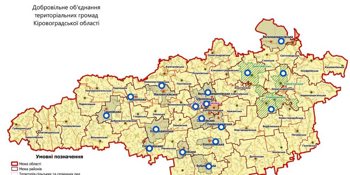
Interactive map of amalgamated hromadas appeared in Kirovohrad Oblast
An interactive map of amalgamated hromadas was created in the Kirovohrad Oblast, as reported by the Kirovohrad Local Government Development Centre.
The interactive map reflects the boundaries of existing and perspective AHs – there are 14 of them. There are also three hromadas – the Novoprazka, Pryiutivska and Dmytrivska AHs, where the first elections were scheduled for the spring 2018.
The Hruzkivska and Maryanivska AHs have already received conclusions from the oblast state administration and are in the process of filing documents to the CEC regarding the appointment of the first elections.
The map is available by the link: https://www.thinglink.com/scene/1032922678643654659

Область:
Кіровоградська областьSource:
Кіровоградський Центр розвитку місцевого самоврядування
29 April 2026
Моніторинг громад – березень 2026
Моніторинг громад – березень 2026
Як змінюється стан справ у територіальних громадах? Як на їхню спроможність впливають безпекові умови в регіонах та...
29 April 2026
Громади отримають нові інструменти для...
Територіальні громади зможуть активніше долучатися до процесу повернення українців з-за кордону та їхньої...
29 April 2026
S3 Present and Future Part 2: Implementation Lessons from the First and Second Cycles
S3 Present and Future Part 2: Implementation...
Smart Specialisation Strategies (S3) are central to EU Cohesion Policy, guiding regional growth, innovation, and...
28 April 2026
Local self-government reform: Key trends in the first quarter of 2026
Local self-government reform: Key trends in the...
The Ministry for Development of Communities and Territories of Ukraine has published the Monitoring Report on the...